Grand Chamossaire
mittel
Skitour
Navigieren
Navigieren
Hol diese Tour auf dein Handy
Karte
Grand Chamossaire
mittel
Skitour
4,00 km
QR-Code scannen und Navigation in der bergfex App beginnen
QR Code
Wandern & Tracking
Wandern & Tracking
Download für iOS
Download für Android

Grand Chamossaire

Distanz
4,00 km
Dauer
03:15 h
Aufstieg
797 hm
Seehöhe
1.307 - 2.104 m
Track-Download
Karte
Grand Chamossaire
mittel
Skitour
4,00 km

The steep ascent leads through meadows and forested areas to the Route des Tailles, where you can enjoy magnificent views of Villars and the surrounding mountains. Continue for another 1.5 kilometres on...


Beschreibung

The steep ascent leads through meadows and forested areas to the Route des Tailles, where you can enjoy magnificent views of Villars and the surrounding mountains. Continue for another 1.5 kilometres on the gently climbing road, beforet turning left and passing under the gondola line to reach Roc d’Orsay. Well-known among regulars, this section requires extra caution in icy conditions. From Roc d’Orsay, it’s only a few hundred metres to the top of Grand Chamossaire.

Beschreibung

Demanding tour up to the top of Villars: the Grand Chamossaire

Technik
4 / 6
Kondition
4 / 6
Landschaft
4 / 6
Erlebnis
3 / 6
Beste Jahreszeit
Jan
Feb
Mär
Apr
Mai
Jun
Jul
Aug
Sep
Okt
Nov
Dez
Autor
Bereitgestellt von Paddy Jansen
Erstellt am 01. Januar 2022
1.990 Aufrufe
Logo
Tour teilen
Karte
Grand Chamossaire
mittel
Skitour
4,00 km
Fehler
Ein Fehler ist aufgetreten. Bitte versuche es erneut.
Zusatzinfos & Tipps
Tipps

Don’t leave any garbage behind, show consideration for the natural environment and the property owners of the land used! The forest is an undisturbed wildlife habitat, so please stay on the marked trails.

Noch keine Bewertungen
Bewertung schreiben

Bewertungen helfen anderen Usern bei der Auswahl ihres nächsten Abenteuers. Bewerte bitte nur die Tour, nicht das Wetter oder deine Jause.

Wähle einen der Sterne um die Tour zu bewerten
Schlechte Tour
Schwache Tour
Mittelmäßige Tour
Gute Tour
Ausgezeichnete Tour
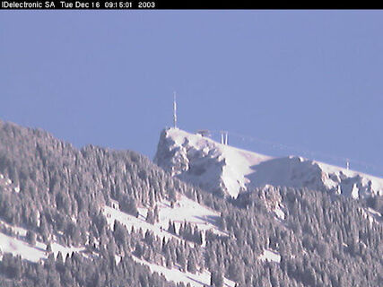
bergfex logoHol dir den EinblickImmer live vor Ort mit über 9.500 Webcams. In der Touren App von bergfex siehst du als Pro-User jetzt zu vielen Touren die passenden Webcams. So kannst du dir direkt die aktuellen Bedingungen ansehen.
Wandern & Tracking

Wandern & Tracking

für iOS herunterladenfür Android herunterladen
Wandern & Tracking
Über 550.000 Tourenvorschläge, detailliertes Kartenmaterial und ein intuitiver Routenplaner machen die App zum Must-have für alle Naturbegeisterten.
Wandern & Tracking