
© EVAdinarica Project - EVA dinarica
© EVAdinarica Project - EVA dinarica
© EVAdinarica Project - EVA dinarica
© EVAdinarica Project - EVA dinarica

- Kurzbeschreibung
-
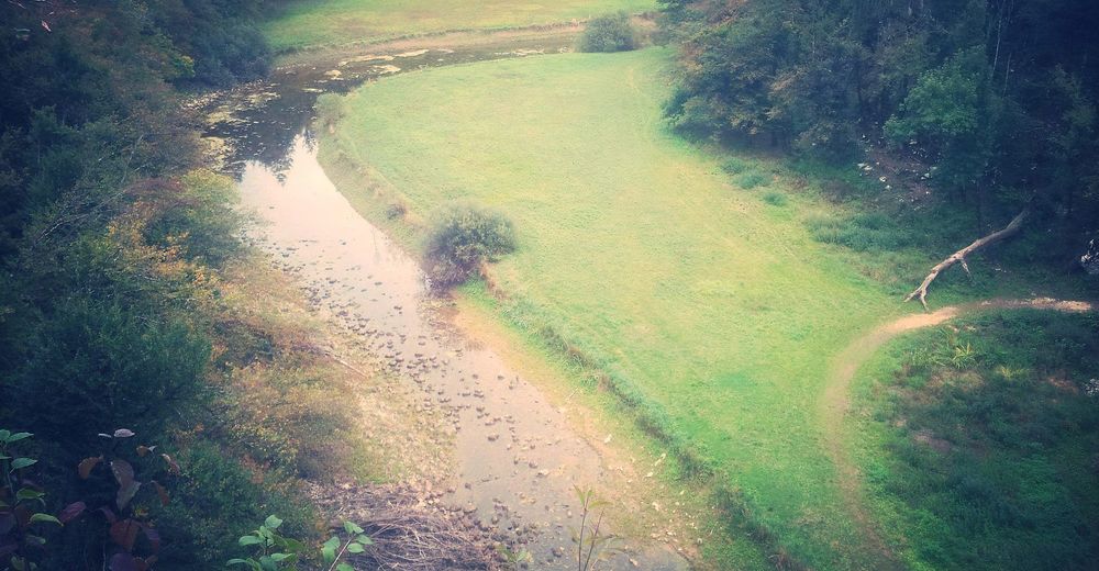
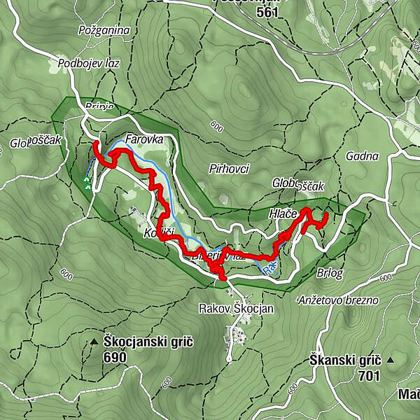
The trail measures 3km, plus 2.5km to return to the starting point, estimated travel time: 3 hours, plus return to the starting point.
- Schwierigkeit
-
leicht
- Bewertung
-
- Wegverlauf
-
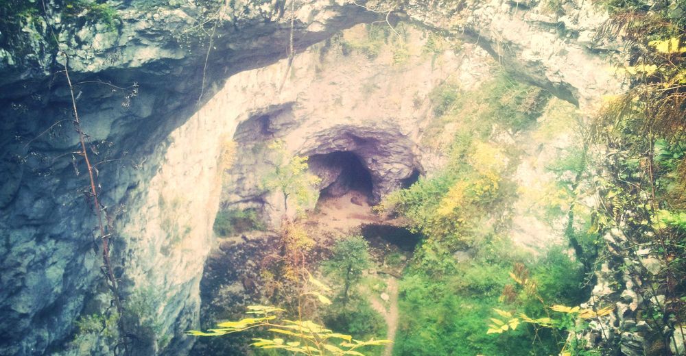
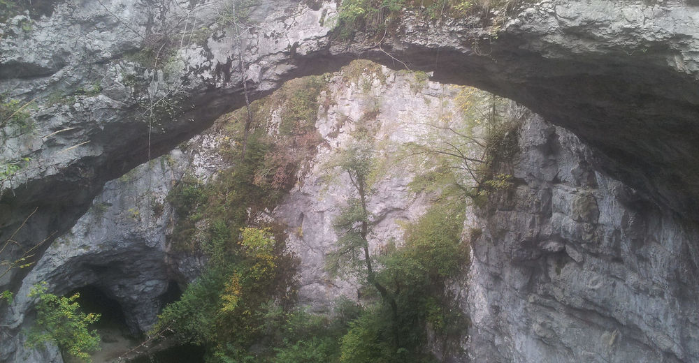
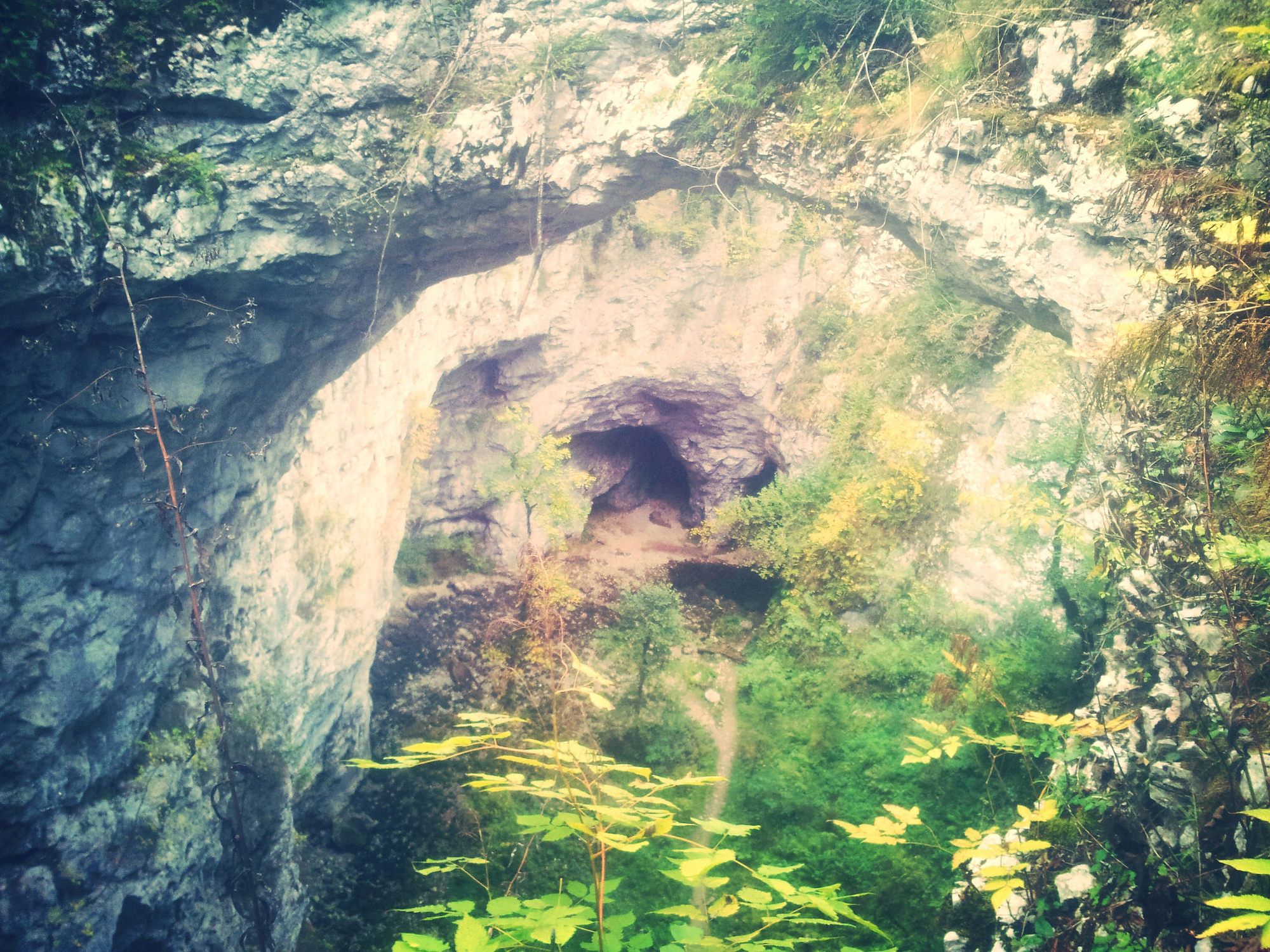
Veliki naravni most0,1 kmKotliči1,4 kmKotel1,4 kmBizerjev laz2,2 kmMali naravni most3,5 kmZelške jame3,6 kmMali naravni most3,7 km
- Beste Jahreszeit
-
JanFebMärAprMaiJunJulAugSepOktNovDez
- Höchster Punkt
- 563 m
- Höhenprofil
-
 © outdooractive.com


-

-
AutorDie Tour The Rakov Škocjan Natural Education Trail wird von outdooractive.com bereitgestellt.
GPS Downloads


Allgemeine Infos
Flora
Fauna
Aussichtsreich
Weitere Touren in den Regionen
-
Notranjsko-Kraška
68
-
Cerknica
26


