Circuit randonnée : Balcon du Pic Aubeill - CASSAGNES

Wanderung

© Unbekannt - © Lionel Moogin-www.pholio-m.com/Agly-Verdouble

© Perpignan Méditerranée Tourisme - ©Lionel Moogin - Agly-Verdouble

© Perpignan Méditerranée Tourisme - ©Agly-Verdouble

© Perpignan Méditerranée Tourisme - ©Lionel Moogin - Agly-Verdouble

© Perpignan Méditerranée Tourisme - ©Lionel Moogin - Agly-Verdouble

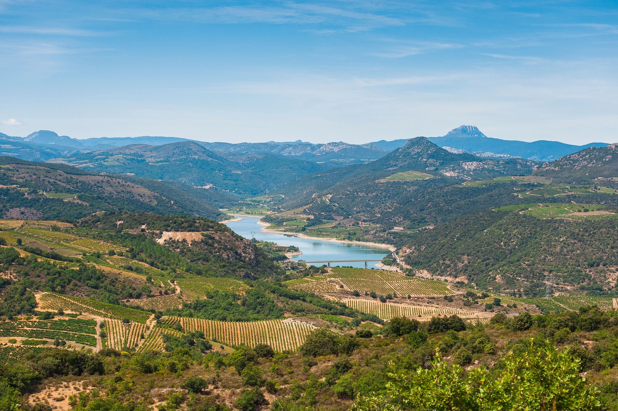
© Perpignan Méditerranée Tourisme - Baills Marie-Claire

- Kurzbeschreibung
-
This easy trail will take you from the village of Cassagnes to the Pic Aubeill (reaching an altitude of 541 meters), with a 360° panoramic view (orientation table) over the region : vineyards, Fenouillèdes villages, the lake on the river Agly and its dam. The views will help you understand better how the landscape was shaped by both geology and human intervention.
- Schwierigkeit
-
leicht
- Bewertung
-
- Wegverlauf
-
CassagnesPic Aubeill (540 m)4,4 km
- Beste Jahreszeit
-
JanFebMärAprMaiJunJulAugSepOktNovDez
- Höchster Punkt
- 525 m
- Höhenprofil
-
 © outdooractive.com


-

-
AutorDie Tour Circuit randonnée : Balcon du Pic Aubeill - CASSAGNES wird von outdooractive.com bereitgestellt.
GPS Downloads


Allgemeine Infos
Einkehrmöglichkeit
Geheimtipp
Aussichtsreich
Weitere Touren in den Regionen