


The Tour Sainte Catherine


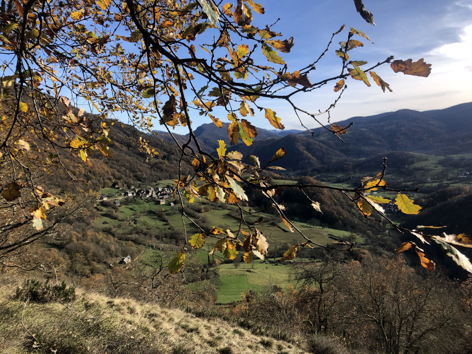
0h 502 m Start from the picnic area. Continue along the road for 100 metres, then take the left-hand path into the Lachein valley. Once you have passed the resurgence of the stream, which is quite characteristic (this water coming out of the ground!), continue as far as a restored barn.
0h 15 min. - Turn right and take the path up to the Sainte-Catherine cave (used by the CNRS laboratory in Moulis to study the underground world, do not go near the edge). Follow the well-marked path and turn left. A steep, winding path takes you to the top of the hill.
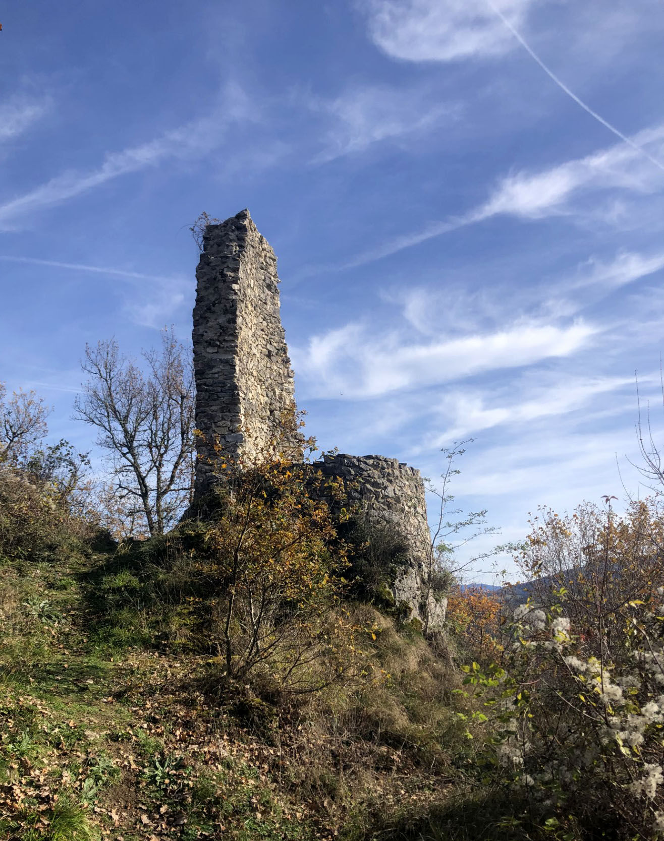
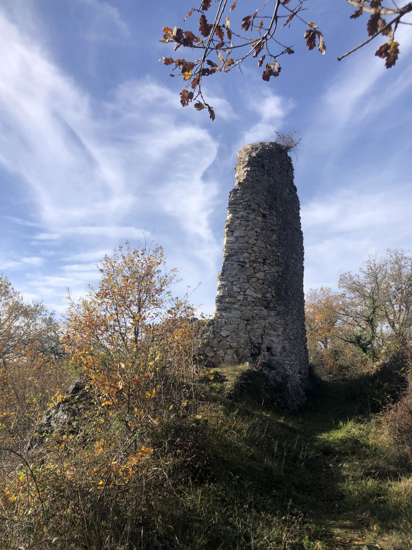
0h 40 - 741 m the Sainte-Catherine tower (watch out for the holes). This is the site of the old Balagué castle-refuge, of which all that remains is the tower, the remains of the enclosure and the foundations of an old chapel. To return, follow the ridge to the left, then turn right.
0h 50 min along the sunken path lined with boxwood, which will take you for about
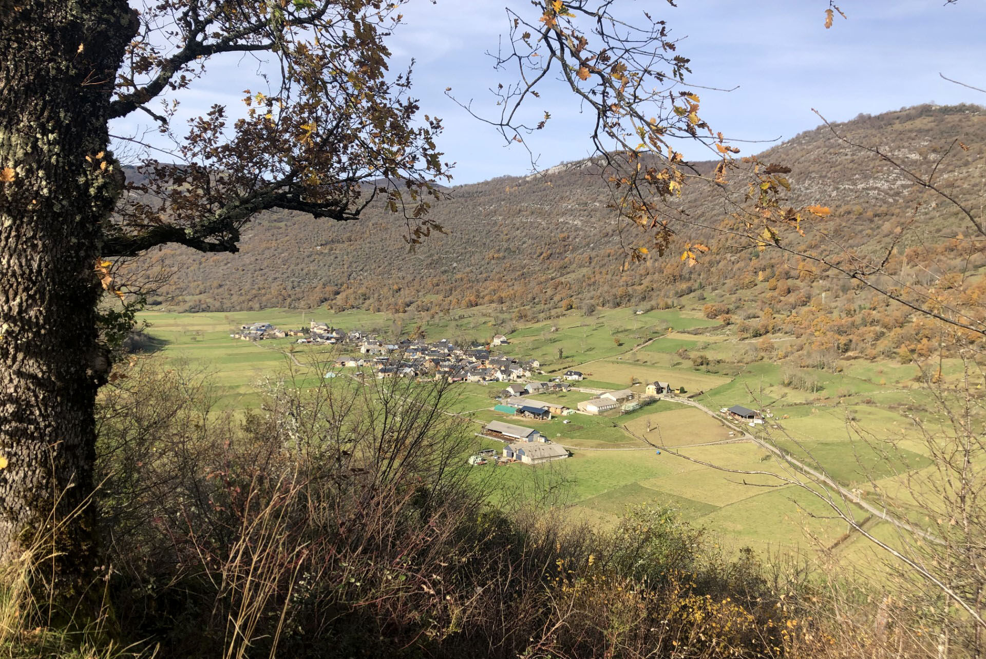
1h to the Balagué road. Turn right onto the road and follow it for 200m before turning right onto the path.
1h15 You will soon find the path at the start of the circuit. Turn left to rejoin the road and the starting point. 1:30 Arrival
Vous êtes au cœur du Parc Naturel des Pyrénées Ariégeoises.
Nous vous encourageons à adopter un comportement responsable dans ce milieu fragile et partagé.
- Rester sur les sentiers et emporter ses déchets.
- Observer la flore sans la cueillir.
- Rester discret, pour les animaux sauvages.
- Dans les zones d’estive, penser à refermer les clôtures et barrières. Ne pas approcher ni nourrir les animaux. Si un Patou (chien de protection des troupeaux) s’approche de vous, écartez-vous lentement et calmement. Pas de grands gestes ni de cris, même s’il aboie, car il vous considérerait comme une menace. S’il vous suit, ignorez-le.
- La baignade dans les lacs est déconseillée. La crème solaire (même bio !) et autres cosmétiques sont source de pollution dans ce milieu fragile.
- Le bivouac est autorisé, mais seulement entre 19h et 9h, et à plus d’une heure de marche d’un parking.
- En période de sécheresse tout feu est interdit. Dans les autres cas, les feux sont autorisés seulement à plus de 200m d’une forêt. Préférer les réchauds aux foyers naturels.
- En cas de rencontre, très peu probable, avec un ours (qui cherche à tout prix à nous éviter) : manifestez-vous calmement, éloignez-vous progressivement, et ne courrez pas.
Beliebte Touren in der Nähe
Tour du Biros
schwerWanderung50,4 kmSur le pas des Hadas
leichtWanderung2,32 kmTour du Mail des Morères
mittelWanderung8,15 kmG 7. Etappe Aucazein-Le Couret, Okzitanien/Frankreich
mittelRadfahren25,7 kmTour du Mail Blanc
leichtWanderung10,8 kmGR 10 Couserans Pyrénées - Castillon
schwerWanderung37,2 kmÉtang d'Ayes
leichtWanderung7,32 kmSoulane de Buzan
leichtWanderung7,85 kmLes sabots de Bethmale - Circuit n°3
leichtRennrad64,7 kmLe Tuc de Montcalivert
leichtWanderung8,40 km

Wandern & Tracking


Verpasse keine Angebote und Inspirationen für deinen nächsten Urlaub
Deine E-Mail-Adresse wurde in den Verteiler eingetragen.