


Tour du Mail Blanc


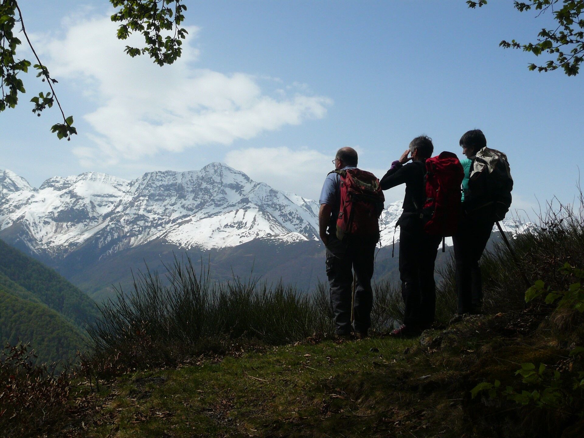
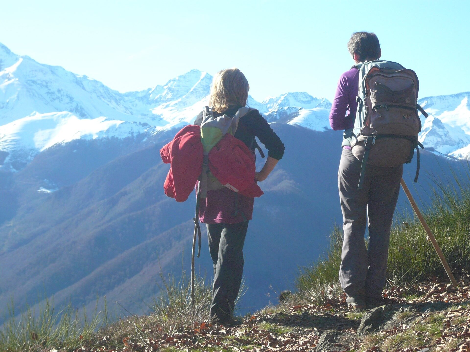
The panorama is ever-changing, culminating in a breathtaking view of the chain as you reach the southern slopes of the Biros.

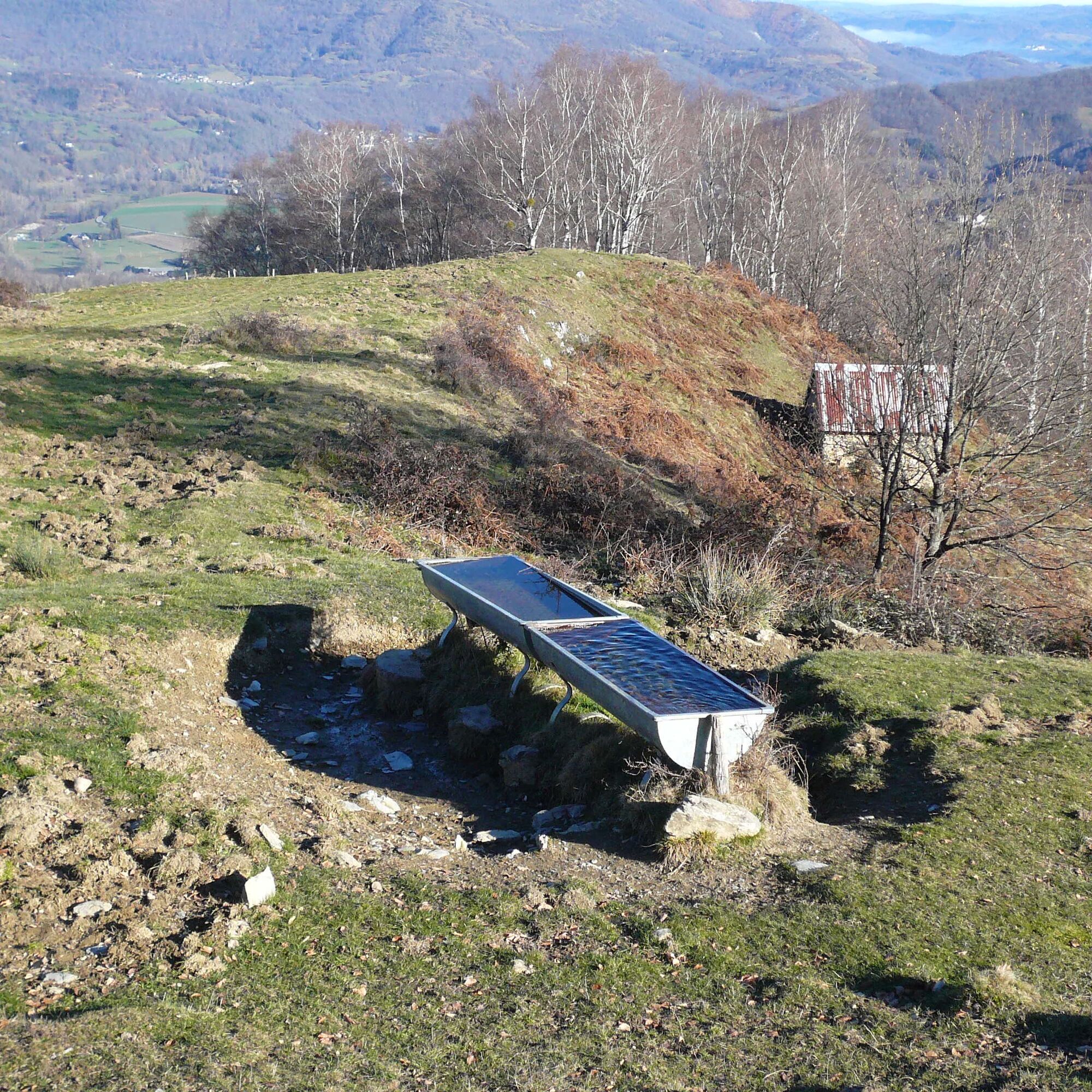
1/ Departure from the village of Salsein d'en haut (watering place) 0h - 725m To start, head down the lane and cross the stream. The lane then becomes a track that you should follow to the crossroads. Head right as the track twists and turns. Be sure to follow the signs, which will keep you on the main path. Then, after an hour's walk from the start, you'll come to a meadow above a
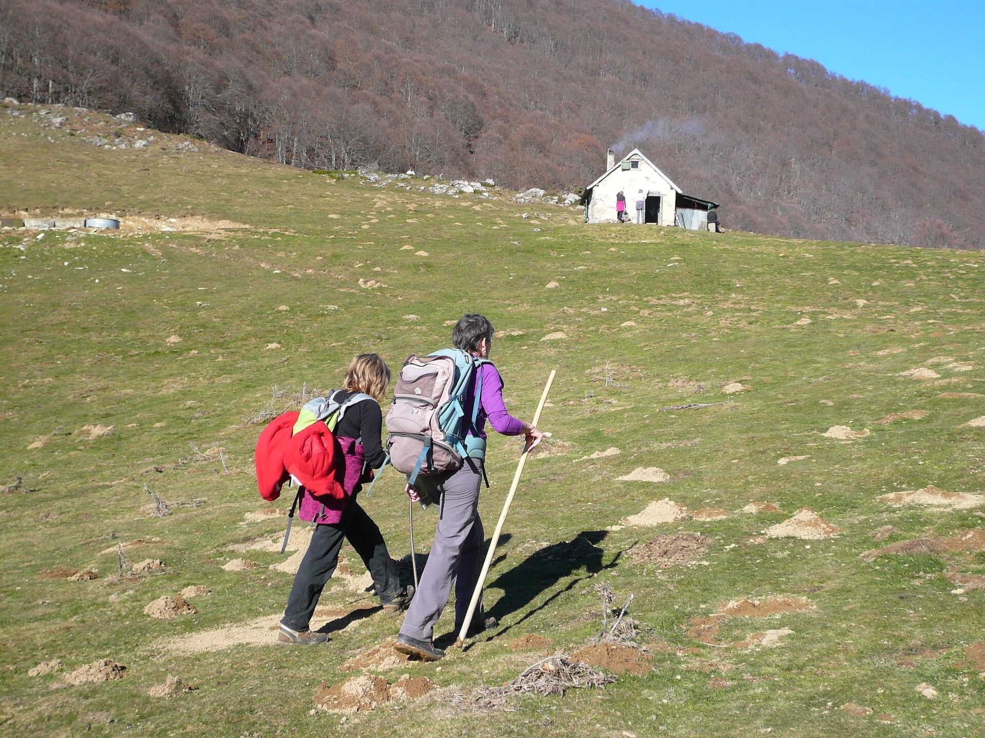
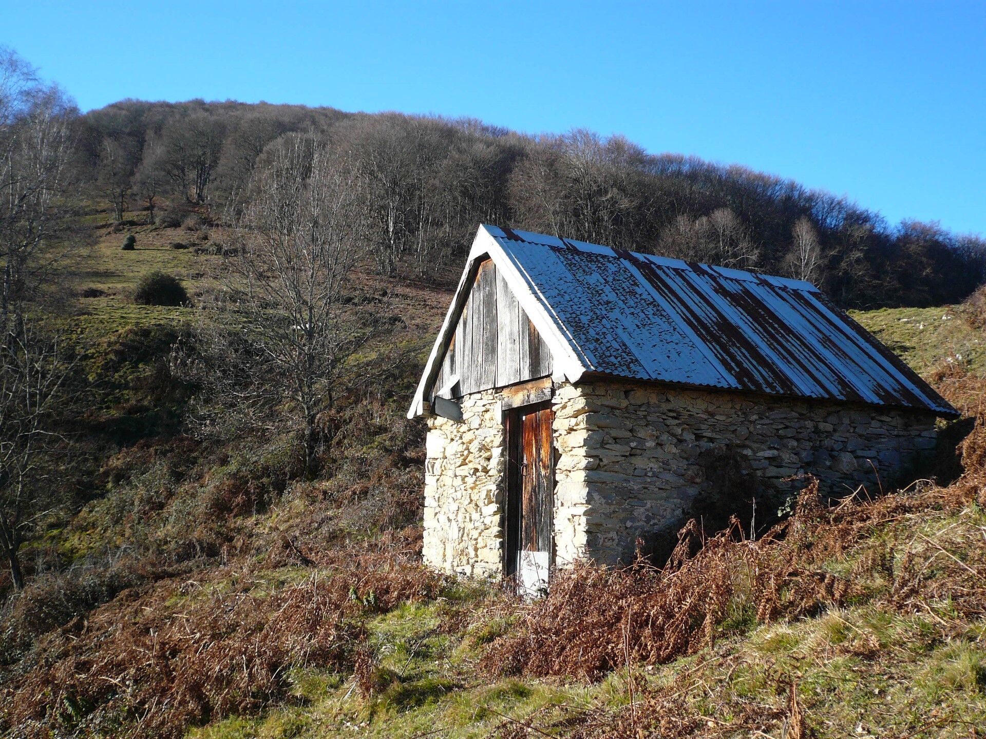
2/ Small hut (below to the east) 0h50 - 810m Follow the track as it winds its way up through the meadow. The markings will take you to a ruined barn in around twenty minutes. Walk alongside the ruin and climb to the right to enter the forest. Follow a faint but well-marked path for 300m until you reach the track, which you climb up to the left. A little further on, the track becomes a narrower path, and you'll soon find yourself on a ridge where you can climb up to the top.
3/ Exit the forest 1h40 - 1120m (breathtaking views) It's time to change sides! Continue along the balcony path, which gradually rises in altitude to reach the Col d'Arraing. Be careful, you will leave a path on the left twice before reaching the hut and the
4/ Col d'Arraing 2h40 - 1355m For the return journey, head due north over the pass to find the signs leading down into the forest to reach the Col de Houga. Join a track that turns left, then right, then left again a little further on. Be careful, as twenty minutes later you will come to a crossroads. Take the one on the right and continue downhill on the wide hairpin path. Keep your wits about you as you follow the signs, which, despite the many possible junctions, will take you safely to the 5/ Col de Houga 3h50 - 840m (barns and houses 100m away) On the right, leave the track by plunging due east down the slope and find your starting point (not very visible from above). You can also choose the full-slope descent, which will take you quickly back to the starting point.
Vous êtes au cœur du Parc Naturel des Pyrénées Ariégeoises.
Nous vous encourageons à adopter un comportement responsable dans ce milieu fragile et partagé.
- Rester sur les sentiers et emporter ses déchets.
- Observer la flore sans la cueillir.
- Rester discret, pour les animaux sauvages.
- Dans les zones d’estive, penser à refermer les clôtures et barrières. Ne pas approcher ni nourrir les animaux. Si un Patou (chien de protection des troupeaux) s’approche de vous, écartez-vous lentement et calmement. Pas de grands gestes ni de cris, même s’il aboie, car il vous considérerait comme une menace. S’il vous suit, ignorez-le.
- La baignade dans les lacs est déconseillée. La crème solaire (même bio !) et autres cosmétiques sont source de pollution dans ce milieu fragile.
- Le bivouac est autorisé, mais seulement entre 19h et 9h, et à plus d’une heure de marche d’un parking.
- En période de sécheresse tout feu est interdit. Dans les autres cas, les feux sont autorisés seulement à plus de 200m d’une forêt. Préférer les réchauds aux foyers naturels.
- En cas de rencontre, très peu probable, avec un ours (qui cherche à tout prix à nous éviter) : manifestez-vous calmement, éloignez-vous progressivement, et ne courrez pas.
Beliebte Touren in der Nähe
Tour du Biros
schwerWanderung50,4 kmTour du Mail des Morères
mittelWanderung8,15 kmSur le pas des Hadas
leichtWanderung2,32 kmGR10 Pyrenäenweg Etappe 30
leichtFernwanderweg7,90 kmG 7. Etappe Aucazein-Le Couret, Okzitanien/Frankreich
mittelRadfahren25,7 kmF 6. Etappe Aulus-les-Bains-Aucazein, Okzitanien/Frankreich
schwerRadfahren60,1 kmMont Valier par l'étang de Milouga
schwerWanderung21,2 kmMont Valier
schwerWanderung17,6 kmPic du Crabère
schwerWanderung23,4 kmGR 10 Couserans Pyrénées - Castillon
schwerWanderung37,2 km
Wandern & Tracking


Verpasse keine Angebote und Inspirationen für deinen nächsten Urlaub
Deine E-Mail-Adresse wurde in den Verteiler eingetragen.