


"The windmills of Montfuron" walk


From the village of Montfuron, which stands proudly on its promontory, the route quickly escapes into the forest, reaches the old gypsum mill, then returns via the Luberon ridges and the remarkable windmill...
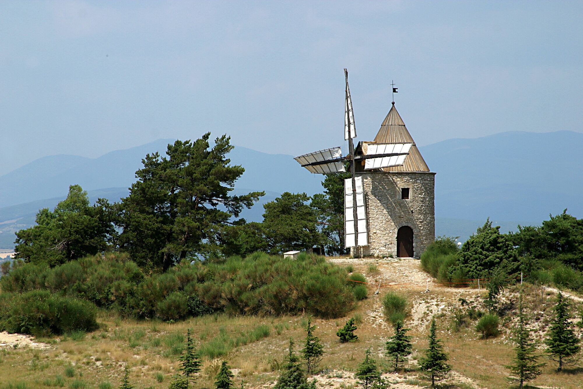
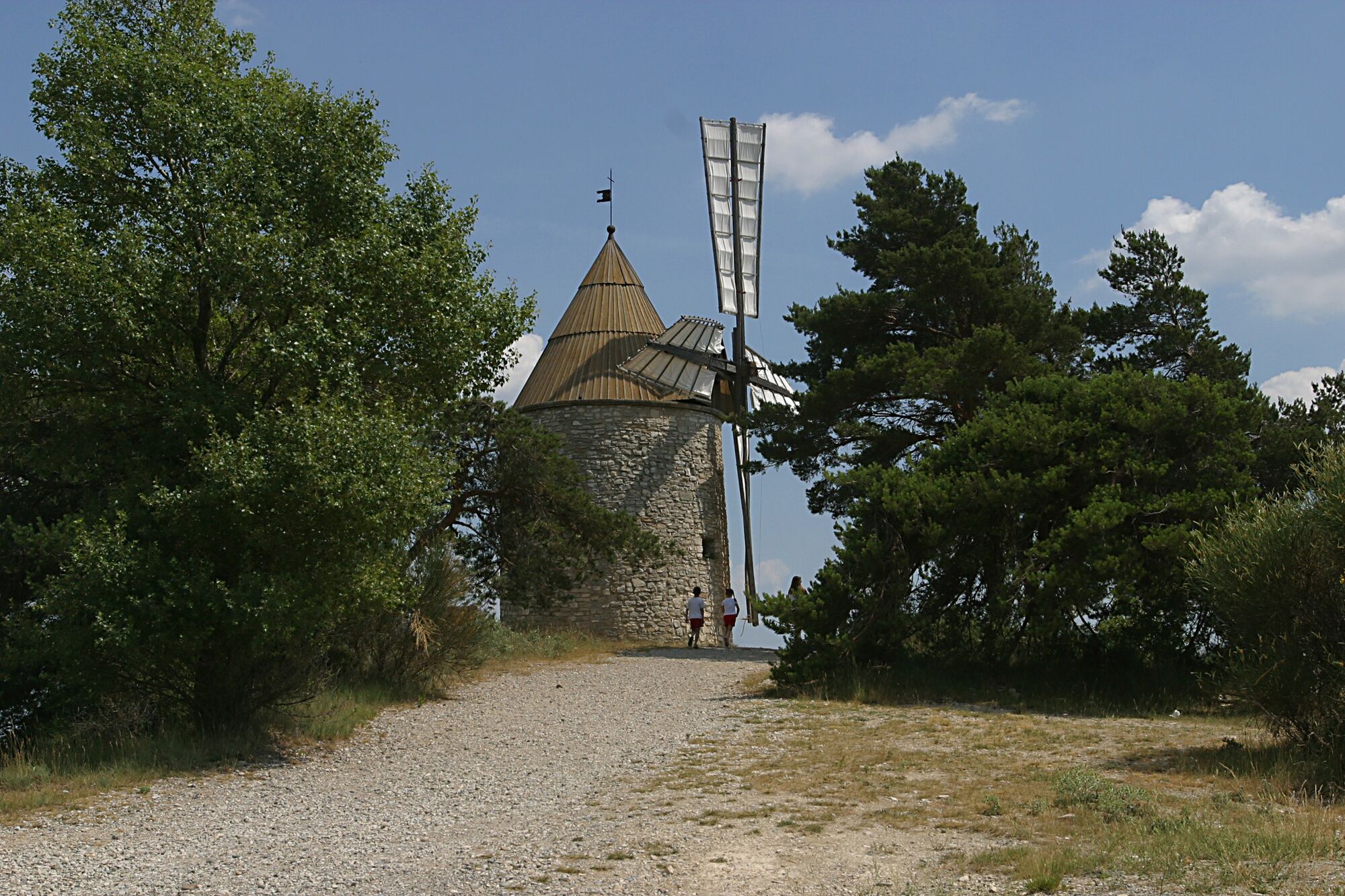
From the village of Montfuron, which stands proudly on its promontory, the route quickly escapes into the forest, reaches the old gypsum mill, then returns via the Luberon ridges and the remarkable windmill dating from 1640, which still stands up to time and the mistral wind. The walk is enhanced by several exceptional panoramic views and ends with the discovery of the ancient Oppidum, then a medieval stronghold.The Montfuron geosite is a perfect illustration of the close, timeless relationship between geology and human occupation.
Stéphane Legal, geologist at PNR Luberon.

On leaving the car park, head left towards the church and immediately right towards the village square.
1- Continue straight ahead along rue de la Rotonde du Château. At the level of the round tower, go down the track opposite, then along large fields. Continue straight downhill along a narrower track. Pass under the power line and continue along the path through the undergrowth on the hillside. After a spring just to the right at the edge of the path, turn off onto a track and follow it up to the right. Go past the ruin of La Joie hidden in the undergrowth (hiking sign) and after a barrier, turn right onto a small road. Turn right.
2- Just before the D956, at the crossroads ''Moulin à plâtre'', rush à right on a pretty path (the ruins of the old mill à plâtre are on the other side of the road (accessès forbidden to the public, risk of collapse!). Continue under the beautiful pines of the Montfuron forest, then walk along the right-hand side of a large field. At the end of the field, cross the talweg, go up a second field and reach a track on the left. Take care to turn left and follow this track to a small road.
3- Take the small road on the right and 100 m further on take the white track on the right. Continue along the criss-cross path. At the top of the hillock, switch to the opposite direction to join the small road. Follow it for 450 m to reach the crossroads with the route de Montfuron (D 455).
4- At the crossroads ‘’Le Pastre’’, follow à right the D455 towards Montfuron. 200 m further on, take the left-hand path which climbs gently up to the windmill. Continue along the track and take the narrower path down to the D455. Take this road on the left for 20 metres in the direction of the village, then turn right into Rue Mistral (one-way traffic prohibited).
5- At the crossroads ''Montée du Château'', cross the chain and climb the revised path up to the belvédère. Reach the viewpoint and the ruins of the old castle, then return to point 5. At this point, turn right and walk straight down rue du Château to reach the village square, then the car park on the left, the starting point of the walk.
Ja
Ja
Wear adapted to the season and conditions (cold, hot, wet…)
Hiking shoes adapted to the terrain (even for children!)
Hiking boots (useful for stability and taking the strain off joints)
Mobile phone and spare battery
In an emergency, contact 112
Car park near the church at the bottom of ave Jean Gineste, or further upstream at the entrance to the village.
To find out more about our destination, visit our website
Do not extract or collect fossils or minerals along the way. The commune of Montfuron, rich in exceptional fossil sites, is within the boundaries of the Luberon Gorgeous Natural Reserve and the Luberon UNESCO World Heritage Site.
ATTENTION PASTORAL AREA on the trail: in the presence of guard dogs coming to meet me, I stop, then calmly walk around the grazing herd
Beliebte Touren in der Nähe
-
Radfahren am Mittelmeer Nr. 2: Apt - Manosque
schwerRadfahren 83,1 km -
MTB Nr. 8 - Grand Tour des Collines von Manosque mit dem Mountainbike
schwerMountainbike 53,0 km -
Itinéraire pédestre "Les chemins de Bellevue"
leichtWanderung 1,62 km -
VTT n°24 - Entre Sainte-Tulle et Corbières
mittelMountainbike 15,3 km -
Itinéraire pédestre "Moulins de Montfuron"
leichtWanderung 4,81 km -
Itinéraire pédestre "Tour de la Garde"
schwerWanderung 8,82 km -
Itinéraire pédestre "Sentier des Vignerons"
mittelThemenweg 5,48 km -
Itinéraire pédestre "Sentiers de la forêt de Pélicier"
mittelWanderung 10,4 km -
VTT n°21 - Forêt de Pélicier
schwerMountainbike 29,1 km -
VTT n°18 - Les Côtes de Bellevue
mittelMountainbike 14,3 km
Wandern & Tracking


Verpasse keine Angebote und Inspirationen für deinen nächsten Urlaub
Deine E-Mail-Adresse wurde in den Verteiler eingetragen.