


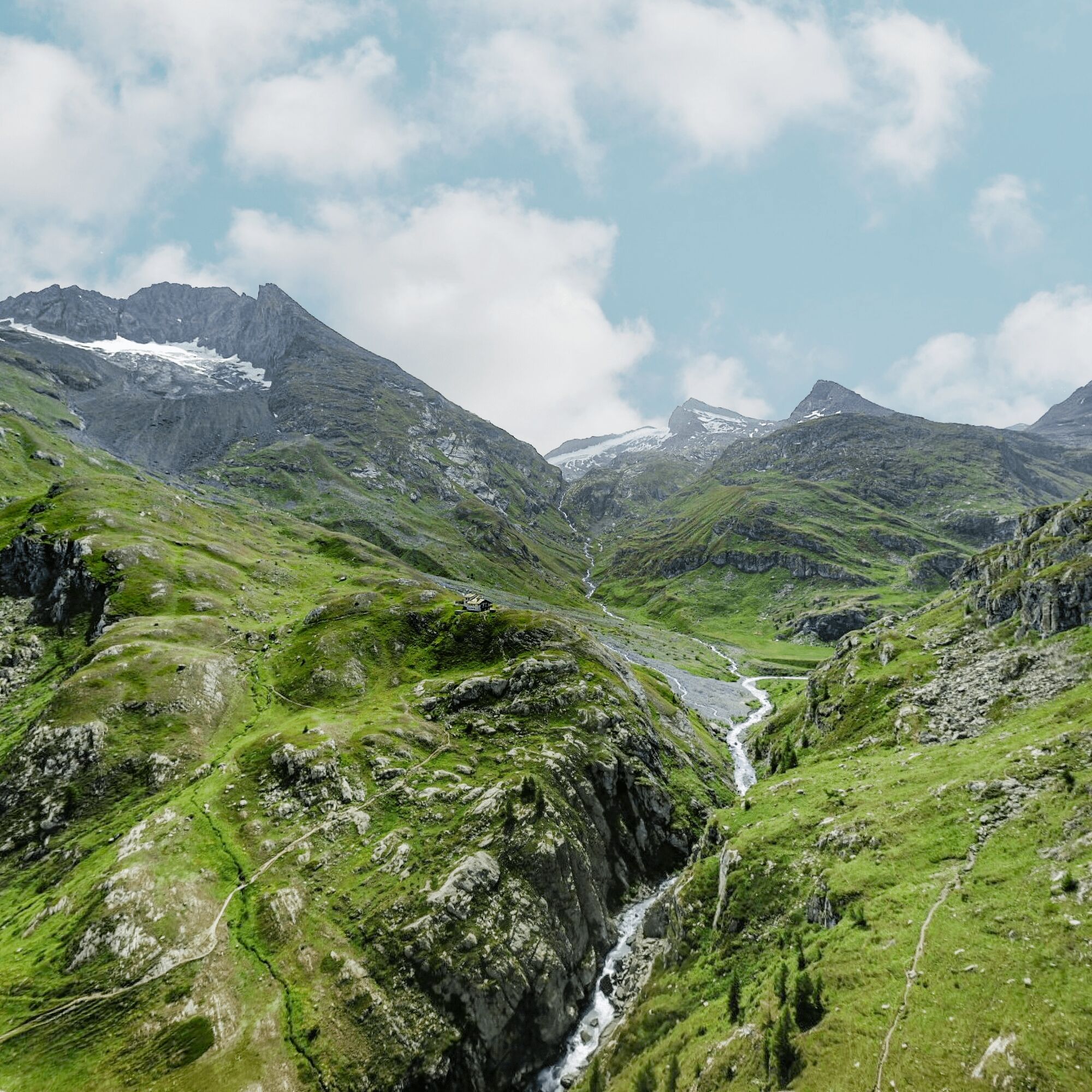
Pas de la mule trail from the Avérole refuge
The Avérole torrent acts as your guide throughout the journey. Fed by streams and glacial lakes that overlook the Lombarde valley, it's a refreshing place for both young and old to rest along the way....
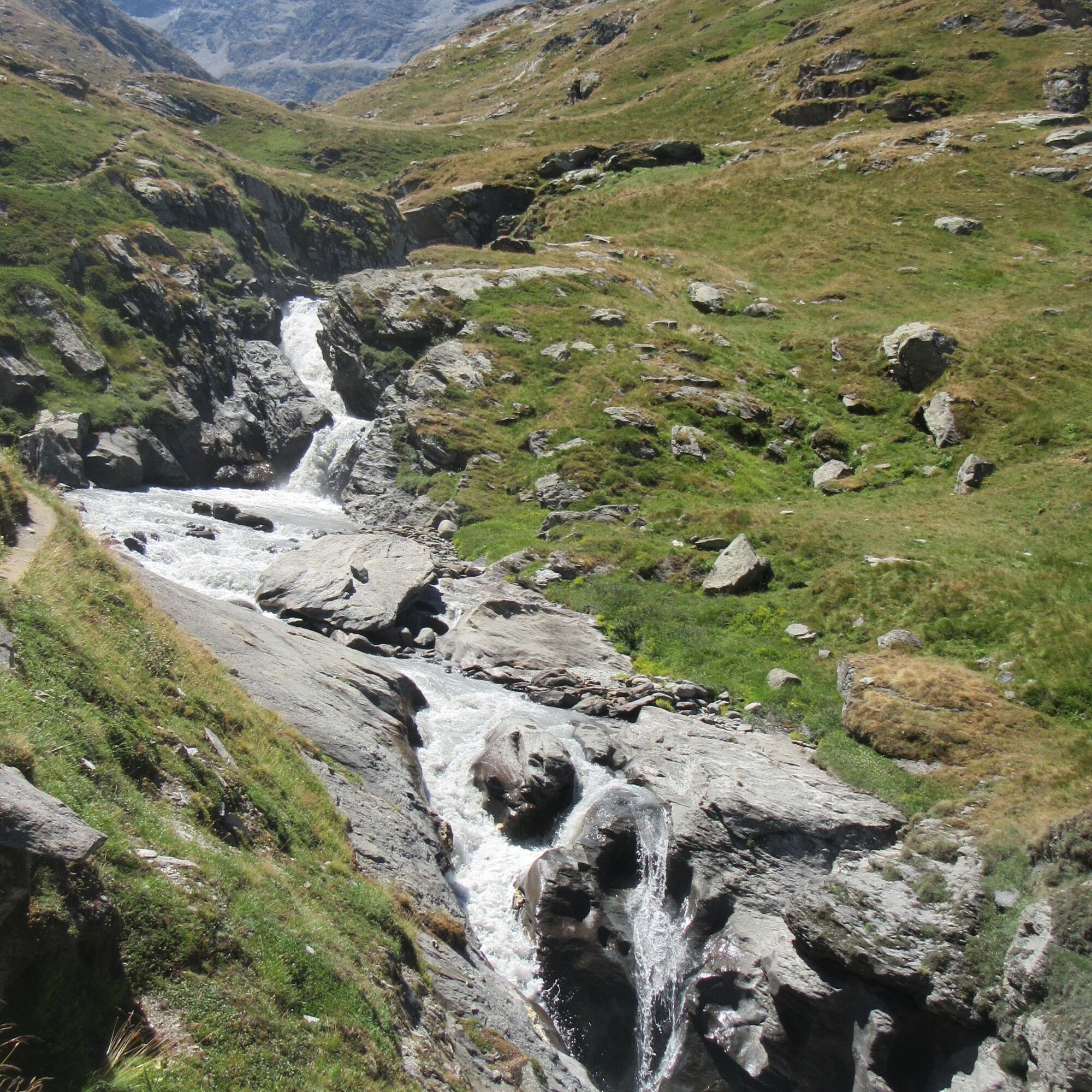
The Avérole torrent acts as your guide throughout the journey. Fed by streams and glacial lakes that overlook the Lombarde valley, it's a refreshing place for both young and old to rest along the way. The trail, which is often playful and always well-maintained, encourages you to maintain your speed. Marmots whistle from distant hiding places, and who knows... there may be chamois up there in the shade of the cliffs, watching you as you go by. These grand, cinema-like landscapes fill you with energy. At this altitude on the south-facing slope, you feel the soft, warm caress of the sun on your face. What a strange feeling when you arrive at your destination! The torrent gently flowing through the village of Avérole is now a distant memory. Here at the shepherds' hut, it goes cascading down into a giant, boiling cauldron. The few hours you've spent hiking along the right bank suddenly feel like whole days of adventure.

To guide you in the field, consult the "step-by-step" directional diagram provided in pdf.
Ja
2/ Using GPX tracks As hazards may occur at any time on the routes, the GPX tracks provided are not contractual. They are given for information only. Riders use them at their own risk, depending on their level of technological proficiency and their understanding of the terrain.
Beliebte Touren in der Nähe
-
4,7
Rocciamelone partedjo dalla Riposa. Mompantero, Piemont/Italien
mittelWanderung 10,6 km -
5,0
Der See Grand Méan über den Cirque des Evettes
schwerWanderung 13,6 km -
5,0
BALME Grüne Seen und Paschiet-See
mittelWanderung 7,51 km -
Petite Haute Mauriennaise
schwerRennrad 32,0 km -
5,0
BALME Anello Arnas - Pian della Mussa
schwerWanderung 13,6 km -
5,0
LEMIE Rundweg der Ovarda-Seen
schwerWanderung 15,9 km -
4,7
Alta Via delle Valli di Lanzo | Etappe 6 Tazzetti-Schutzhütte – Malciaussia-See
mittelWanderung 5,49 km -
5,0
Alta Via delle Valli di Lanzo | Etappe 4 Schutzhütte Stadt Ciriè – Schutzhütte Cibrario
schwerWanderung 12,0 km -
USSEGLIO Schwarzer See vom Malciaussia-See aus
leichtWanderung 4,79 km -
USSEGLIO See hinter dem Turm und der Rossa
schwerWanderung 17,1 km

Wandern & Tracking


Verpasse keine Angebote und Inspirationen für deinen nächsten Urlaub
Deine E-Mail-Adresse wurde in den Verteiler eingetragen.