



Romantic Rur Valley (Hiking Loop 55)

From the hikers’ car park, first go back out to the road. On the opposite side of the road, you will see the buildings of a former cotton wool factory, a remnant of the days when Monschau was one of Europe’s...
From the hikers’ car park, first go back out to the road. On the opposite side of the road, you will see the buildings of a former cotton wool factory, a remnant of the days when Monschau was one of Europe’s major textile-making centres. What was once the machine room now houses the workshop of a local sculptor.
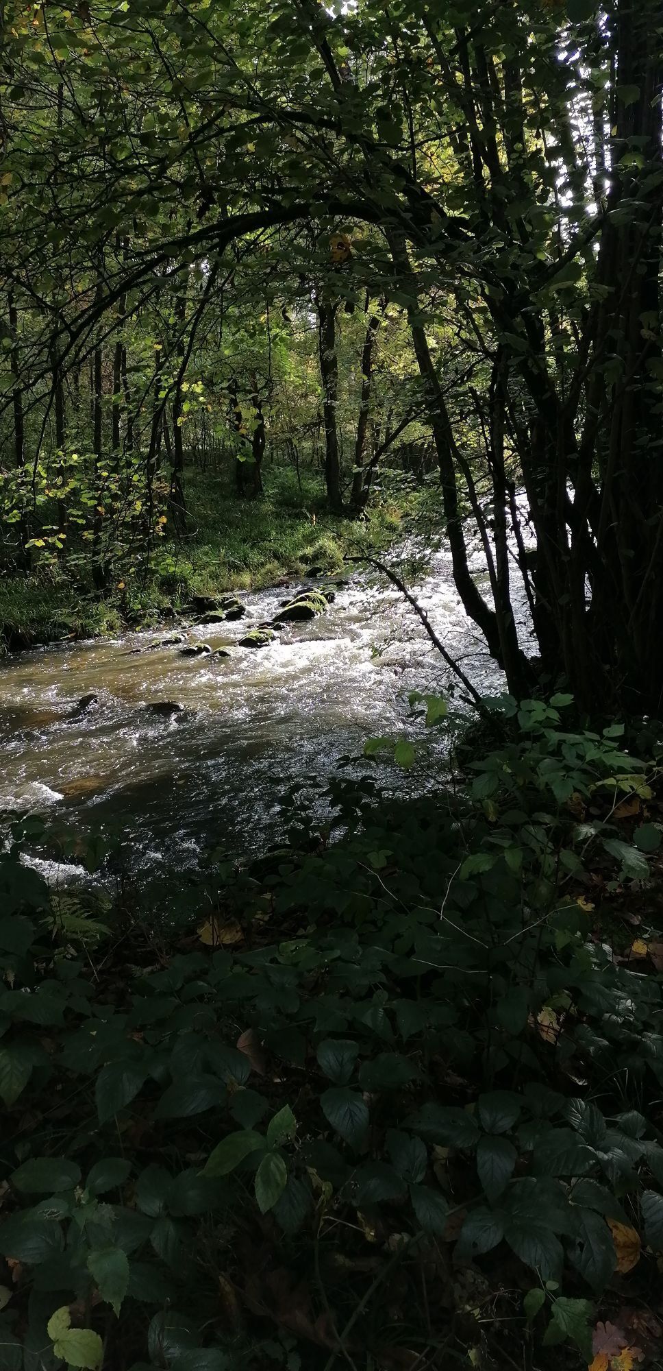
After you cross the Rur river, a fairy-tale path leads you upwards, into the unspoilt hillside forest until you reach the source of the Hasselbach stream, a spring in the midst of fertile meadows. You may find it hard to believe that for centuries, the path you are on was a major thoroughfare between Kalterherberg and Monschau. But if you look, in some places you can still clearly see the tracks that iron-clad wagon wheels carved into the rock as they passed here, again and again, hundreds of years ago. The trail around the edge of the Kalterherberg plateau provides a beautiful example of just how varied a forest landscape can be. You will walk through light spruce forest, dense brush, and virgin hardwood saplings, all alternating and recurring as you go. In summer, the trail edges are bursting with colour as the native flowers and plants like daisies, clover, buttercup, red foxglove and lupine.
At “Hesjesbuer”, hikers are treated to a panoramic view for miles, from Kalterherberg to the south west to Höfen in the east. Hikers will notice the unusual surface of the agricultural road. In olden times, the road was shorn up by a hard-packed layer (which was backbreaking work, all done by manual labour) to prevent heavily laden carts and wagons from sinking into the soft soil. Your next forest passage leads you up a slope to high above the Rursee Lake. Through a gap in the trees, you get a glimpse of the old Premonstratensian monastery Reichenstein, which was built around 1132 atop a hill on the west bank of the river Rur. A charming but steep path leads down to the Norbertus Chapel, built in 1926 in memory of the founder of the Premonstratensian order and the monks and nuns of Reichenstein.
Cross the Rur again and your path climbs to the route of the former Vennbahn, once a railway line that has now been transformed into one of the most beautiful cycling tours in Europe. It stretches the entire distance between Aachen and Luxembourg. One of its most impressive bridges is the viaduct over the Ermesbach. To the west, your view is dominated by the pond and the roofs of Reichenstein. Look the other way and you will see Reichenstein monastery’s mill, which the monastery made available for use by the people of Kalterherberg in 1562. The oldest parts of the present building date from 1692.
If you are here in spring, on the other side of the bridge you will see an ocean of yellow cascading down the steep slope: these are the thousands upon thousands of daffodils that bloom here every year. You then enter one of the most beautiful sections along the entire course of the Rur. The mountain stream begins changing character, now flowing silently, now rushing noisily between the defiant stones. When you reach remains of the “Fischerhütte”, or “fisherman’s hut”, there is nothing but a few remnants of walls to tell you that at the start of the 20th century there was a luxurious destination restaurant here with a whole range of its own attractions, including a summer toboggan run, swimming pool, billiards and water recreation.
As you reach the end of the loop, you will see the youth campsite Dreistegen on your right. At the spot where today you will find a footbridge over the Rur was once Monschau’s “river bathing locale”. But its patrons must have been extremely motivated, because even in summer the waters of the Rur rarely get warmer than 16°C.


The loop is marked in both directions (follow trail number 55). Despite some mild ascents and descents, this hike is suitable for all hikers. Apart from a few paved sections, the hike is on unpaved, wild paths and trails.
Hiking map no. 3, Monschauer Land - Rurseengebiet “Monschau region - Rursee Lake area” publicated by Eifelverein offers additional context for orientation. (ISBN: 978-3-921-805-52-X)
Parts of this hike are on uneven and unpaved paths and trails, so you are advised to wear sturdy shoes and weather-appropriate clothing.
Please stay on the designated paths.
To plan your individual trip by car, use our journey planner and enter “Monschau, Dreistegen” as your destination.
For your full journey by public transport and fare information, see: www.avv.de
Free parking is available at the Dreistegen hikers’ car park.
There are numerous food and drink establishments in Monschau’s historic old town centre.
Beliebte Touren in der Nähe
- 4,5
Eifelsteig Etappe 3
mittelWanderung 24,5 km - 4,5
Der Jahundertweg
schwerWanderung 18,2 km - 3,0
Hautes Fagnes - Château Reinhardstein
leichtWanderung 16,3 km - 4,0
Bei Höfen auf den Eifelsteig
mittelWanderung 12,7 km Rundweg Baraque Michel
Wanderung 22,7 km- 4,7
Xhouffrais - Sourbrodt
leichtWanderung 18,3 km - 3,3
Wasser, Wolle, Schiefersteine
mittelWanderung 13,3 km - 5,0
Monschau Runde #LL2ROM V02
mittelWanderung 4,08 km - 4,5
Stadtrundgang Monschau [15]
leichtWanderung 2,33 km - 4,5
Signal de Botrange - Baraque Michel - Chapelle Fischbach
leichtWanderung 8,60 km
Wandern & Tracking


Verpasse keine Angebote und Inspirationen für deinen nächsten Urlaub
Deine E-Mail-Adresse wurde in den Verteiler eingetragen.


