





Mount Ainos
This is the longest and most exhaustive tour. The exposure to the north and the forest protect well against the sun. Closed shoes are recommended. Given the distance and elevation gain a medium tour, although...
This is the longest and most exhaustive tour. The exposure to the north and the forest protect well against the sun. Closed shoes are recommended. Given the distance and elevation gain a medium tour, although no technical difficulty. Bring your own water and food, there are no facilities in the way.
While the entrance is not easy to find, the remaining track is clearly marked and well maintained. Just follow the red/yellow signs.


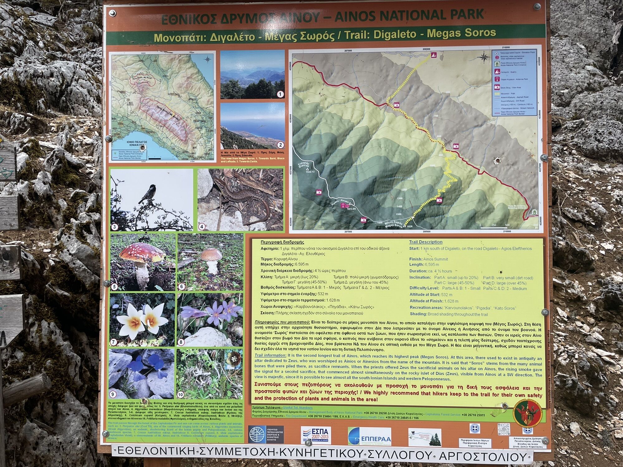
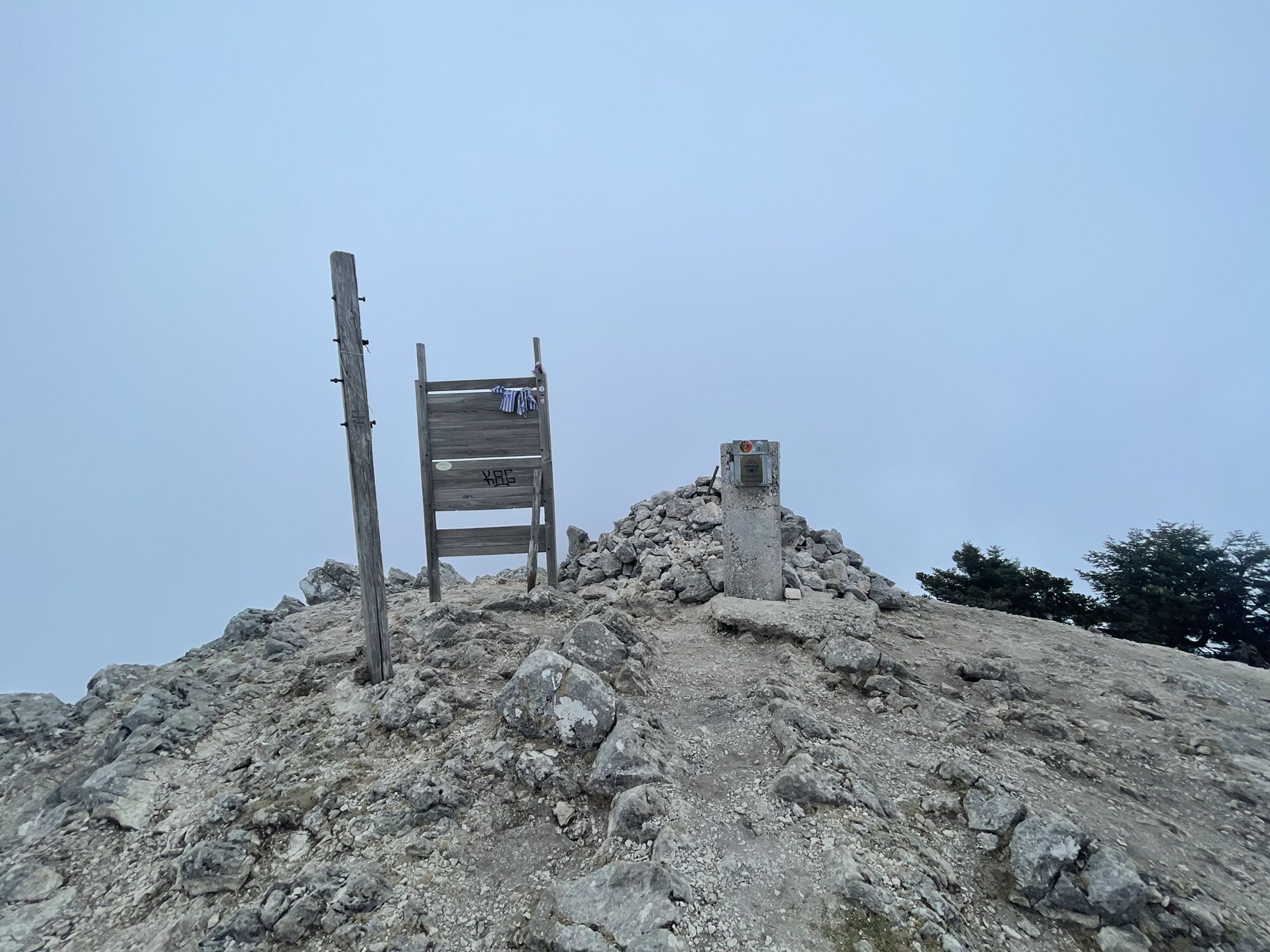
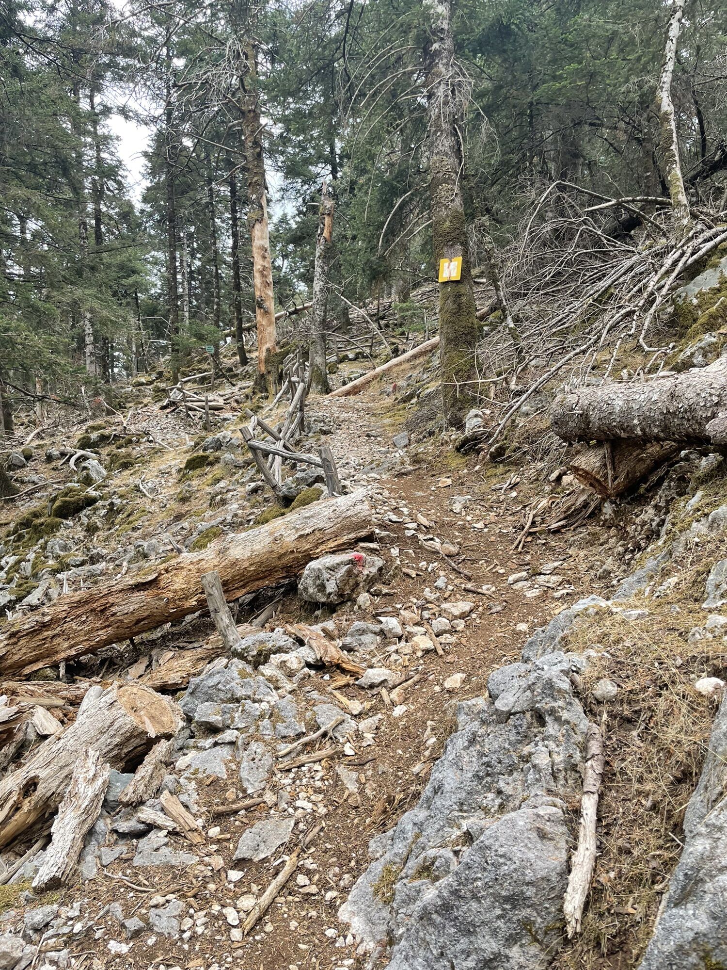
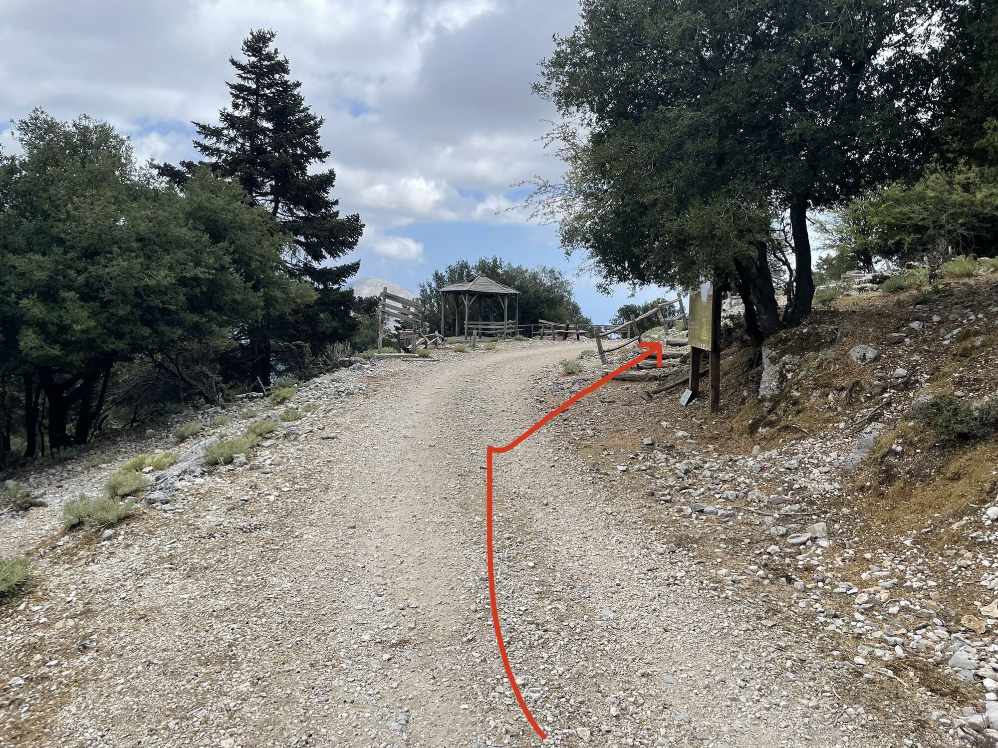

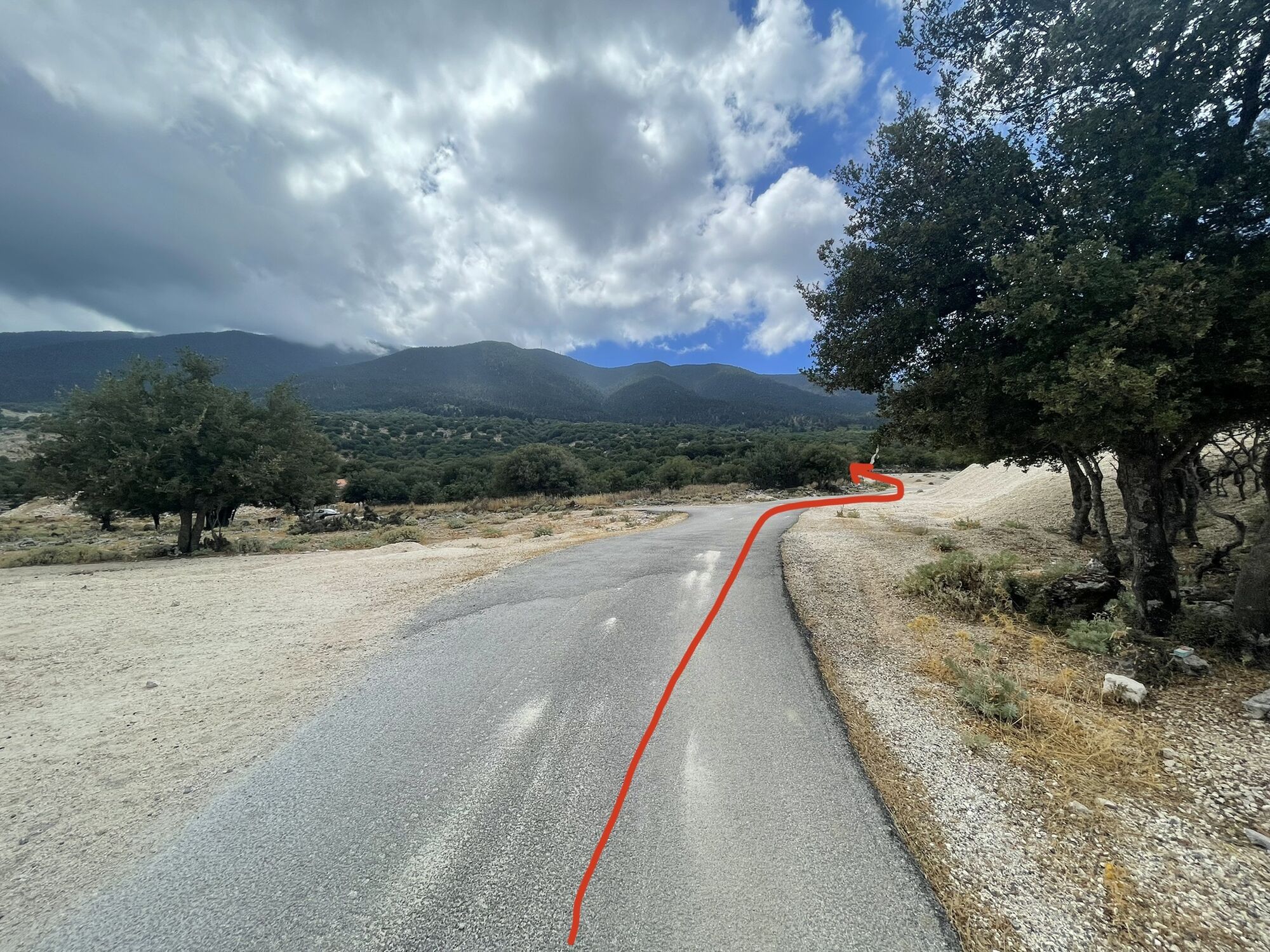

The start is south of Digaleto at the entrance to a gravel pit. Follow the paved road upwards towards mount Ainos, after 100m a small gravel track starts. Continue the path upwards in direction of mount Ainos until you reach a gravel road and a viewpoint after 30 mins. Turn left and follow the gravel road for 20 mins until you reach a second viewpoint. Turn right and follow the tracks upwards (2h). Just before the peak, the track crosses a gravel road.
Decent the same way.
Closed shoes, running shoes or mountain shoes
Car to Digaleto
n/a
At the entrance of the gravel pit

Beliebte Touren in der Nähe
-
Δήμος Αργοστολίου - Denis - Εκκλησία Άγιος Θωμάς - Πεσάδα
leichtWanderung 7,84 km -
Πόρος - Πηγή Τζανάτων - Τζανάτα
mittelWanderung 11,6 km -
5,0
Δήμος Αργοστολίου - Μεγάλος Σωρός - Μέγας Σωρός
mittelWanderung 9,75 km -
Δημοτική Ενότητα Ελειού-Πρόνων - Old Skala Church - Σκάλα
leichtWanderung 9,15 km -
Καραβόμυλος - Σπήλαιο Δρογκαράτη - Kallithea Tavern - Μεγάλος Σωρός
schwerMountainbike 52,0 km -
Σάμη - Σπήλαιο Δρογκαράτη - Χαλιωτάτα - Kallithea Tavern
schwerMountainbike 45,2 km -
Λάσση - Μεγάλος Σωρός - Agia Barbara - Prokopata - Παναγιά η Σισσιώτισα
schwerRennrad 61,5 km -
Δήμος Αργοστολίου - Μεγάλος Σωρός - Μέγας Σωρός
mittelWanderung 10,1 km
Wandern & Tracking


Verpasse keine Angebote und Inspirationen für deinen nächsten Urlaub
Deine E-Mail-Adresse wurde in den Verteiler eingetragen.





