


Kneipp circuit
Walk in the footsteps of Kneipp's philosophy. The energizing circuit walk runs right next to the Treffauer creek. From the town center follow the road downhill towards the south until you reach the "5...
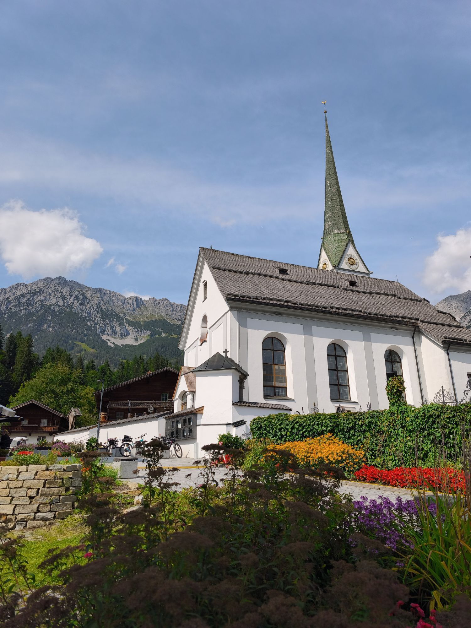
Walk in the footsteps of Kneipp's philosophy. The energizing circuit walk runs right next to the Treffauer creek. From the town center follow the road downhill towards the south until you reach the "5 pillars" on the left. A path leads down in the forest where you find the first station, the barefoot path. Continue to the open-air inhalatory, where salt water trickles on fir-branches and cleanses the airways. Thereafter, you train on the veins stairs, relax at the mediation place and find the answers in the eagle labyrinth. Then the path climbs gently and brings you back to the village. The walk ends at the church with a cooling water basin for arms and legs.
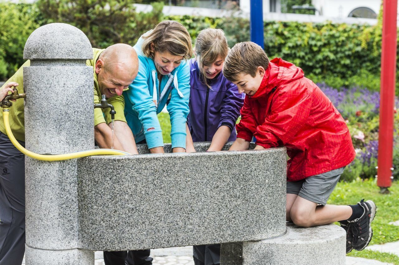
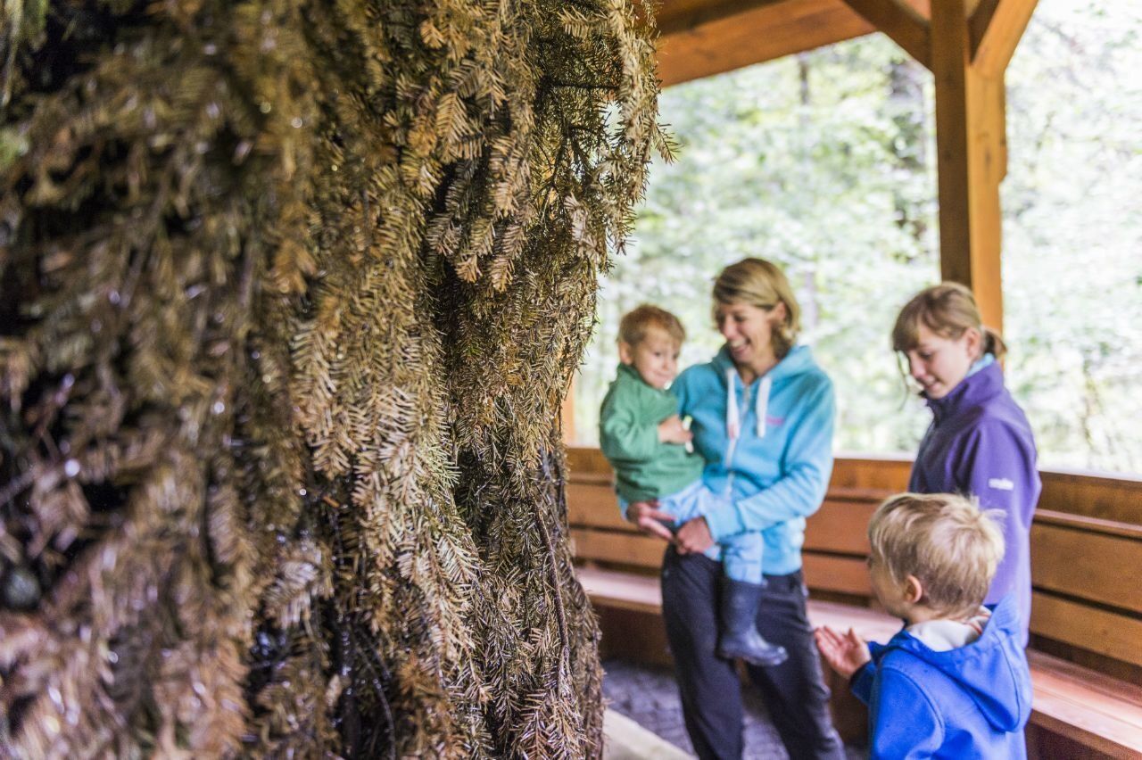
Walk in the footsteps of the Kneipp philosophy. This Kneipp energy circuit runs along the Treffauerbach stream directly adjacent to the village. Follow the street away from the centre until you reach the “5 pillars”. The first station is already waiting for you down in the forest: a barefoot path provides stimulation on different types of ground, from mulch and pebbles through to peat mud. Continue to the open-air inhalatorium, where salt water trickles onto pine brushwood and clears the airways. Try a training session on the vein steps, meditate in a clearing and look for answers in the Adlerlabyrinth. Once you are finished, the path leads you back to the village via a gentle climb. The circuit ends by the church located at the meeting place, with a chance to cool off in a walking pool and an arm dip basin.
Wilder Kaiser hiking map (1:25.000) available in the tourist information centres Ellmau, Going, Scheffau and Söll
Rucksack, sturdy hiking shoes, weather-appropriate hiking gear, sun protection, waterproofs, snack and drink, hiking poles (height adjustable) if required, mobile phone, plastic bag for waste, hiking map, route description and information materials (GPX track), ID, cash
Heading from Wörgl, Kufstein or St. Johann on the B178 road, take the exit to Scheffau. Shortly before you come to the church, you will see the Tourist Info and the hiking starting point on the left-hand side (short-stay parking zone).
Public car park, Scheffau (740 m), north of the Community Hall - free
Beliebte Touren in der Nähe
- 4,7
Kirchdorf: Zur geheimnisvollen Teufelsgasse
mittelWanderung 7,90 km - 4,9
Streif Wanderweg
mittelWanderung 5,73 km - 4,7
Musikantensteig zur Naunspitze
mittelWanderung 8,96 km - 4,6
St. Johann in Tirol: Wasserfall & 3 Seen am Kitzbüheler Horn
mittelWanderung 12,7 km - 4,5
Über Hintersteinersee und Walleralm aufs Hochegg
leichtWanderung 12,2 km - 4,5
Wanderung um den Hintersteinersee
leichtWanderung 5,29 km - 4,6
Hintersteinersee
mittelWanderung 9,87 km - 5,0
Stripsenjoch Klettersteige/ Rundwanderung von Griesener Alm über Stripsenjochhaus und Feldberg
mittelKlettersteig 10,2 km - 4,9
Route 209: Brechhornhaus-Choralpe
schwerMountainbike 24,4 km - 4,2
Bergdoktor Wohnhaus "Gruberhof" (Köpfing Hof) Rundeweg-Söll
leichtWanderung 8,70 km
Wandern & Tracking


Verpasse keine Angebote und Inspirationen für deinen nächsten Urlaub
Deine E-Mail-Adresse wurde in den Verteiler eingetragen.